Saturday, July 26, 2014

St. Marcus Commemorative Park

St. Marcus Commemorative Park is 1 of 108 St. Louis parks.  This 25.5 acre plot of land is located off of Gravois, just north of the Cecil Place and just east of the Gravois/Kingshighway intersection in the Boulevard Heights neighborhood.
I used to live near here for years, so this review will have some personal perspective.  For instance, there are red tailed hawks and fox that hunt in this area.  I cannot seem to find the proof, but I am convinced this part of the city was either a former landfill or common dumping grounds; or maybe when the cemetery was abandoned, it was filled and graded with crude fill dirt.  Why?  When my kids were little they would take a spoon or a shovel and dig in the park and bring all their finding home; I did a post about it back in March, 2010.

Furthermore, we lived here before, during and after the installation of the Great Rivers Greenway bike/pedestrian trail that goes from Holly Hills Boulevard near Christy Avenue all the way to the River Des Peres and beyond.  This park was a dead space before the trail.  The trail brought in hundreds of new trees, a nice wide trail, signage and grand entry ways...and of couse cyclists, dog walkers, strollers and people.  If you build it they will come...the park was activated and now an positive, vibrant space vs. a dead space.  To say the least, this is the greatest thing that has happened to St. Marcus Commemorative Park and the surrounding area including the series of parks that make this greenway:including Christy, Joseph Leisure, River Des Peres Greenway and the River Des Peres Extension parks.
St. Marcus Commemorative Park started as a German Evangelical cemetery established in 1856 and was closed in 1960.  Old St. Marcus was dedicated on March 29, 1856 in the presence of Pastor G. W. Walls of St. Marcus Parish and Pastor L. Nollau of St. John Parish. The cemetery was divided into an area for family plots and an area for single graves ("commons").  Only a fraction of the cemetery's graves (2,290 of about 19,5000 total) were maintained through perpetual care, leading to neglect and dereliction. Burials were prohibited by the city after 1960. It was sold to the city in 1977 and afterwards turned into a walking park. Although many of the original grave markers remain, most have been destroyed through vandalism or have been moved. Money from the cemetery's sale was used to move graves under perpetual care to New St. Marcus Cemetery.
The new St. Marcus Cemetery is in the unincorporated area of St. Louis County called Affton, MO on the border of St. Louis near Gravois and River Des Peres Boulevard.

The park is a really a sloping piece of land at his highest point near Gravois and going down toward Ruth Drive to the east.  The bike path that goes through here is winding with a tree lined border.
The park was rededicated to U.S. Veterans whose head stones were made into a walls and frame a small seating area.
 3 shade trees would go a long way toward shading this peaceful spot

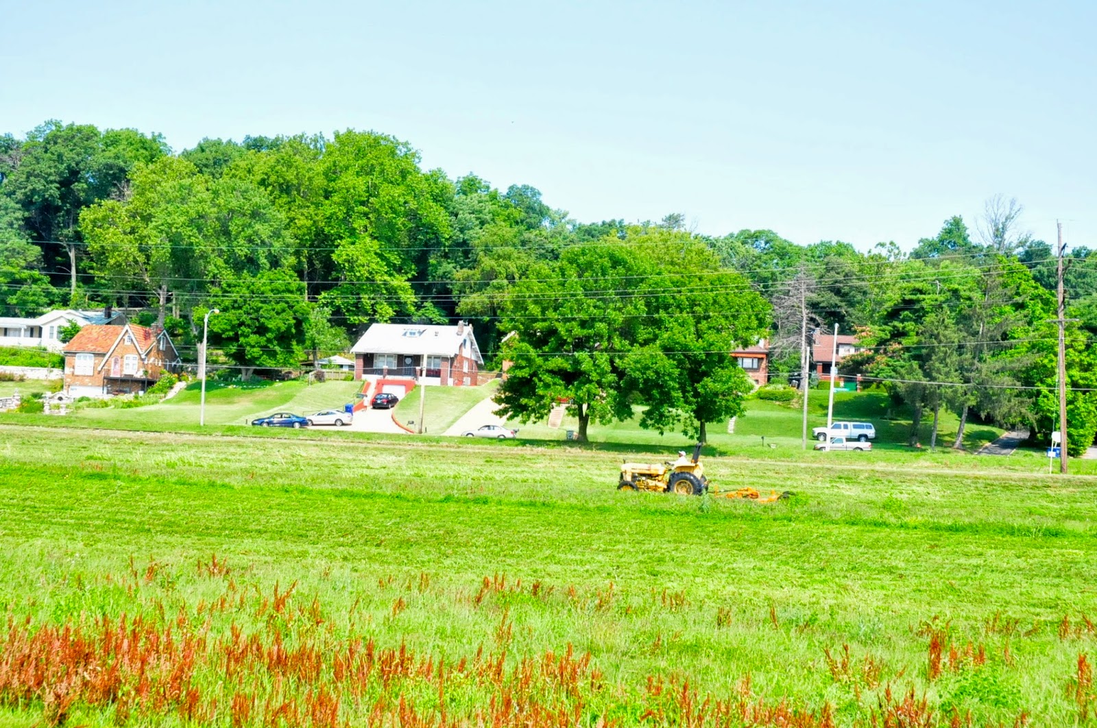
The pool in the background is the Concordia Turners, a membership-only pool and recreation facility.

The graves are kind of sad as the city park's dept doesn't fix them or anything.  They don't move them, they just weedwack and mow around them as they've become vandalized over the years.
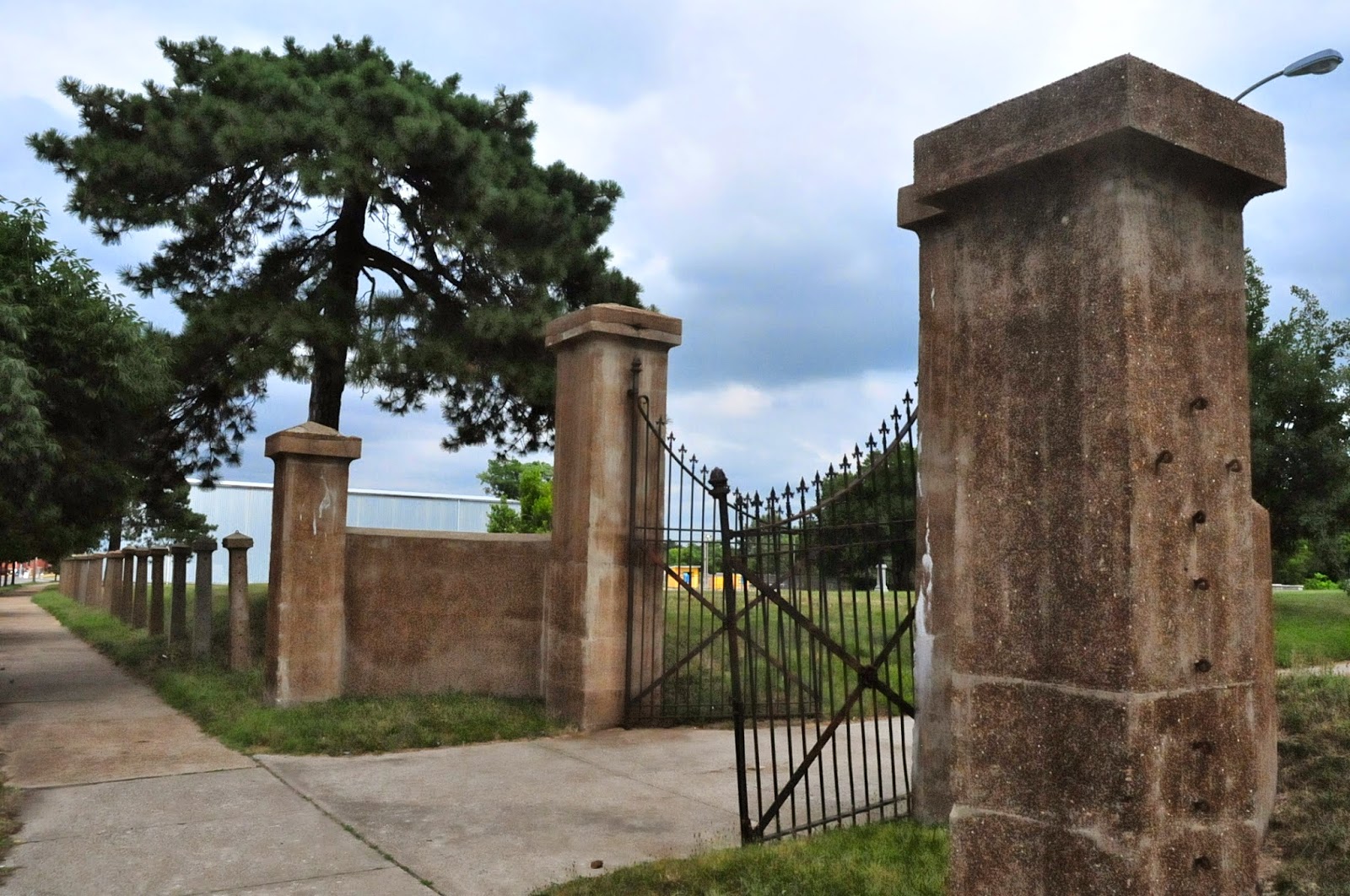
The park still has the remnants of a concrete and metal fence along Gravois.
It's great to see St. Marcus Commemorative Park now clearly connected to the massive trail system on the southside.

Friday, July 25, 2014

W.C. Handy Park

W.C. Handy park is 1 of 108 St. Louis parks. This 11.96 acre park was placed into ordinance in 1941 and and is located in the Kingsway East neighborhood.  Per the city website the park was dedicated as W. C. Handy Park on June 22, 1960 in honor of William Christopher Handy (1873-1958), the world renowned "Father of the Blues" and composer of the "St. Louis Blues" who was born in Florence, Alabama. (source)


W.C. Handy spent time in St. Louis around 1893; enough time to inspire one of his best known works: "St. Louis Blues", one of the first blues songs to succeed as a pop song. The song was published in 1914 by Handy's own company. The song gained so much popularity that it inspired the dance step the Foxtrot.


The park is bordered by Lexington Avenue to the north, North Euclid to the west, Shreve Avenue to the east and Ashland Avenue to the south:


This park might just be the perfect size.  The homes that surround the park are among the most unique I've seen; check out these mid-century homes mixed in with the usual St. Louis classics.


Back to the park...there are 2 playgrounds, one for little kids and one for older kids.


There is a ball field and plenty of open space with a really nice walking/jogging path complete with work out stations/equipment.


The basketball court is in excellent condition and there is a horseshoe pit that needs rehabilitation of another use.


This part of the neighborhood is arguably the most stable.  It has a nice feel.  There were women jogging by themselves, always a good barometer of park safety/stability.

Does anyone know what the following once was?


There is a cool looking mid-century bathroom and utility building as well.


W.C. Handy park makes me think a 12 acre park might be the perfect size for a neighborhood park.

Wednesday, July 23, 2014

North Riverfront Park

North Riverfront Park is 1 of 108 St. Louis parks.  This massive 250 acre park was placed into ordinance in 1980.  This is the northernmost park in St. Louis on the eastern edge of the Riverview Neighborhood.


This park is great for two reasons.  First, of all the parks, this one has the best relationship with and access to the Mississippi River.  This is the spot most popular with fishermen.  Guys drive and walk right up to the banks and fish for mainly buffalo.  This local delicacy, usually fried as described to me by the guy I talked to.  You cast with heavy test line and poles that look like they are intended for the ocean.  These fish get big.


We chatted about river fish being part of the area and how Kram Fish (around since 1904) in the Columbus Square neighborhood has just about everything you could ever want to eat that comes out of local rivers.


The other thing great about this park is the fact that the 10.8 mile North Riverfront Trail that connects the old Laclede Power Building at Lenore K. Sullivan and Biddle just north of the Arch to the old Route 66 Chain of Rocks Bridge, goes right through the park.

 Trailhead just north of the Arch


Old Chain of Rocks Bridge:  northern terminus of the Riverfront Trail

Great Rivers Greenway, the awesome regional institution connecting the metropolitan areas with hundreds of miles of trails has worked to rehabilitate this trail from 2005-2007 and there is now good signage and public art to keep this gritty, real, industrial trail interesting.


 Mary Meachum Freedom Crossing


There is a dedicated rest stop at North Riverfront Park.


The park is just east of Bob Cassilly's Cementland.


The park is largely the bike trail, the river and a lot of mowed grass/weeds that takes an army of workers to mow/weedwack.  I was there on a day when the city was working and it just seems so obvious that this land should be an extension of the River, a natural landscape.  A controlled burn and native grass re-installment would remove the need for mowing, allowing the Park's Dept to focus efforts on the neighborhood parks.  It would also provide a habitat for the plants and animals that are native to the area and it would provide a beautiful "break" between Riverview Boulevard (Speedway) and the Mississippi River.  It would hold up and anchor the soil during the rare flooding as well.


one of many tractors required to...mow

I totally understand there are spots that should be reserved for picnics/concerts/gatherings, etc.  But, the vast majority of the acres should go no-mow.  It just seems so obvious.

I would love to see Great Rivers collaborate with the City to do a native prairie restoration on the vast fields of grass/weeds.