Saturday, April 26, 2014

Serra Sculpture Park

The Serra Sculpture Park is one of a series of six parks along Market Street in the Downtown West Neighborhood.  Working west from Tucker Boulevard and Market Street you have Poelker Park, Washington Square Park and Kaufmann Park, then Memorial Plaza Park (including Eternal Flame Park and the one across from the Park Pacific which is not listed on the city website), Aloe Plaza and Aloe Plaza West.  The beautiful and peaceful Soldier's Memorial Military Museum is also part of this stretch of land and I will include that in a separate post.

The 1.14 acre park, placed into ordinance in 1981 is bound by Market Street to the south, 11th Street to the west, Chestnut Street to the north and 10th Street to the east:


The park's name and claim to fame is owed to artist Richard Serra sculptor of "Twain".  


Serra is an American minimalist artist born in 1939 in San Francisco, educated at Cal-Berkeley and Yale, and was commissioned to do Twain:


                                         Richard Serra

I came across an excellent essay:  "Re-envisioning Richard Serrs's "Twain"" written by Meridith Mckinley that beautifully describes the history of this public work of art.
It was an opportunity that attracted the young artist (Serra) due to its proximity to the groundbreaking design of the Gateway Arch by Eero Saarinen, which was less than 10 years old at the time.  Serra thought of his proposed structure—a quadrilateral arrangement of eight steel plates—as the dark horizontal counterpart to the bright vertical arch. (source)
More from the Regional Arts Commission:
His massive sculptures, which mostly consist of slightly curved plates of steel, tower vertically over the viewer or extend horizontally along the flat landscape, such as in Twain, located on a square patch of grass in downtown St. Louis. Commissioned specifically for the square-block site, Twain resembles a peripheral fence that, when viewed from above, takes the shape of a skewed triangle. The piece is composed of eight plates of weathering Cor-ten steel; seven of the plates are 40 feet long and the eighth is 50 feet long, which throws the triangle slightly off kilter. (source)

Twain was riddled with controversy from its begins when the sculpture was seen as non-traditional and challenging.  This work was planned and discussed back in 1974; although, through many delays, it didn't come to fruition until 1981.  
Nearly a decade passed before final approval was granted for Twain.  Evolving ideas about the Gateway Mall slowed the process, as well as public concern.  Many in the community were wary of Serra’s design, which was neither commemorative nor ornate in a traditional sense.  The sculpture required something new from its viewers: participation and a spirit of curiosity. 
Welcome to the Show Me State.  Maybe the saddest thing to me is the unfinished nature of the 1.14 acre tract.  Serra had a full vision for the property and sadly through neglect and apathy that vision was never realized.
Serra's first impression when he visited the site was how the flat landscape created an overwhelming sense of sky. He chose to emphasize the land and highlight its subtle changes by making the tops of the plates level, mimicking the slope of the land. Serra designed the piece with the narrow eastern end pointing to the Mississippi River like the prow of a boat; the other end widens out in recognition of Western Expansion. Between the plates are gaps that are two feet wide, through which people can pass. Viewing the piece from the inside provides glimpses of the surrounding architecture and street activity.  
Each detail from the plant material to the furniture was hand-selected by Serra.  The site was leveled and the eight steel plates were anchored into place.  The city block was then re-graded to the original slope of the Missouri Plateau, which subtly falls southeast towards the Mississippi River.  Sod provided an instant lawn inside and around the sculpture.  No paths were planned except those made by future foot traffic.  Serra had no objection to the worn paths eventually being paved, but he did not want to determine how people would navigate the site.  30 high-leafing trees—sycamores, pin oaks, scarlet oaks and red maples—were eventually to rise 80 to 100 feet above the sculpture.  The trees were strategically planted around Twain so as not to block the views of the city.  24 Victorian-style benches and a dozen elegant lamp posts were chosen to light the surrounding area.  From its current appearance in 2014, it is hard to imagine that Serra intended Twain, with all of its hardness and geometry, to be surrounded by the softness of what he described as an “English-style” landscape.  (source)


Photograph of “Twain” during construction, St. Louis, 1982  © Robert Pettus  © 2014 Richard Serra / Artists Rights Society (ARS), New York, NY


Detail of an architectural plan generated by the St. Louis Department of Parks, Recreation, and Forestry for the landscaping of “Twain”, 1983, Saint Louis Art Museum Archives

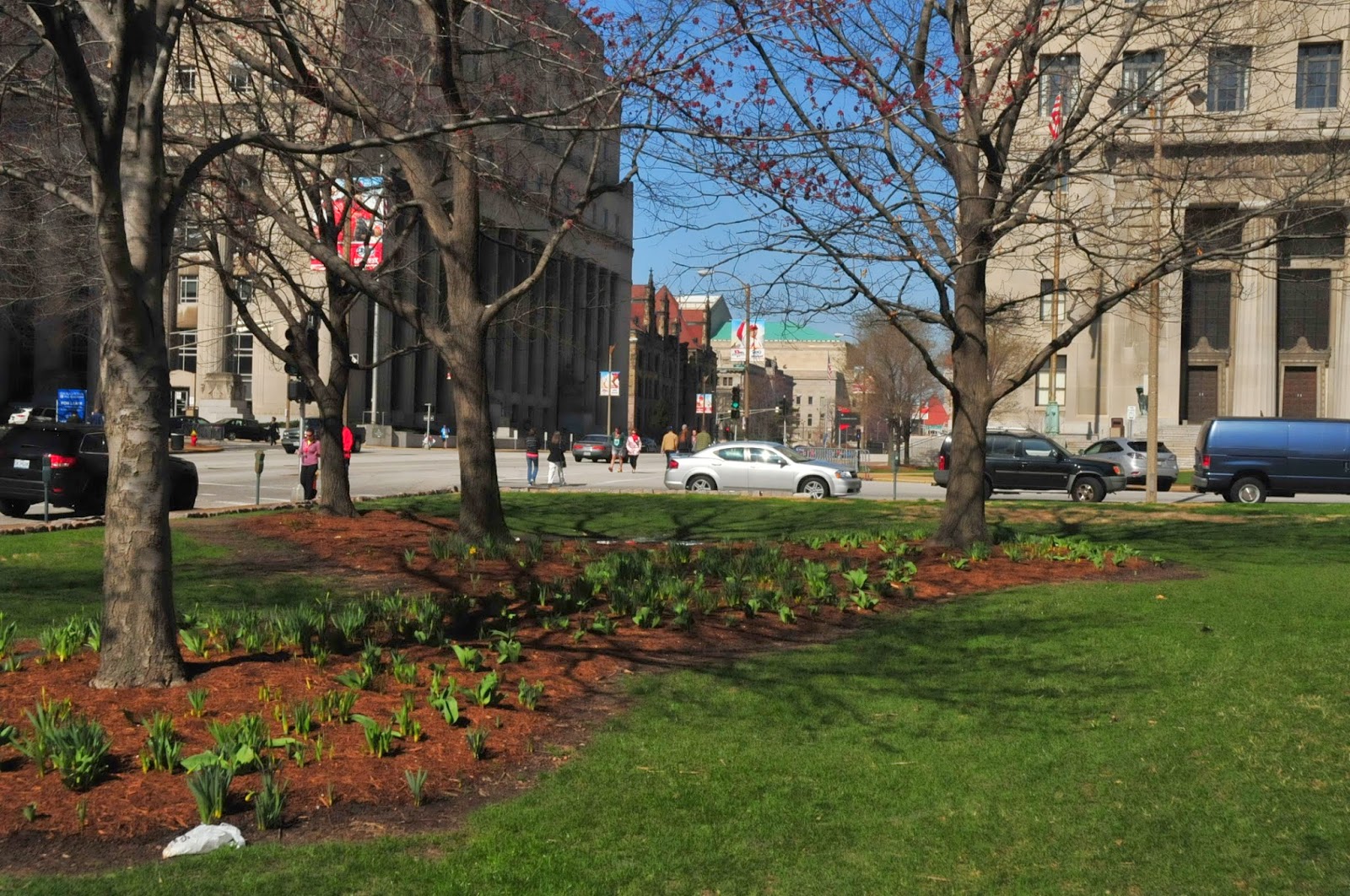
11 of the 30 trees planted died and were never replanted.  No love, no attention.  Today the property has some trees remaining with scattered mulch and tulip and daffodil bulbs. 


No fancy benches nor lights as originally intended.  Just a simple plaque in the ground:


Serra has another sculpture in St. Louis at the Contemporary Art Museum called "Joe".  It seems easier to get behind due to its size, placement and setting.  


"Joe" photo source:  St. Louis Regional Arts Commission

I too have personally struggled to appreciate Twain as it sits between the Civil Courts building and the fantastic, fully realized and cared for City Garden.


Civil Courts Building to the west

City Garden at night to the east

City Garden at dusk

In fact in my anecdotal experience, it's pretty much a consensus that Twain is one of the more controversial works of public art in St. Louis.  It is misunderstood at best or disliked at worst.  Ghost graffiti, dying grass and urine from the scads of homeless concentrated downtown mark the piece today.


If I was calling the shots, I'd arrange a one-for-one trade of sculptures with the sprawling outdoor Laumeier Sculpture Park is suburban West County.  Twain would seem to have a better context in that serene setting among the rolling grass lawns flanked by woods, as opposed to lurking in this forgotten block like a jealous sibling in the shadow of the whimsical City Garden right across the street.

The city could use something more bold in this stretch of Market Street.

Twain could use some love, and I tried to let my curiosity settle in and appreciate it. I feel Serra's effort was noble and just...maybe now is an appropriate time to share a quote from another Twain:

"There are no accidents, all things have a deep and calculated purpose; sometimes the methods employed by Providence seem strange and incongruous, but we have only to be patient and wait for the result: then we recognize that no others would have answered the purpose, and we are rebuked and humbled."  -  Mark Twain
Maybe Twain is perfect and perfectly placed and I just haven't seen it in the right angle, right light with the right song playing in my head to make it all click...most seem to walk right by like it's not even there.

Sunday, April 13, 2014

Washington Square Park

Washington Square Park is one of a series of six parks along Market Street in the Downtown West Neighborhood.  Working west from Tucker Boulevard and Market Street you have Poelker Park, Washington Square Park and Kaufmann Park, then Memorial Plaza Park (including Eternal Flame Park and the one across from the Park Pacific which is not listed on the city website), Aloe Plaza and Aloe Plaza West.  The beautiful and peaceful Soldier's Memorial Military Museum is also part of this stretch of land and I will include that in a separate post.


According to the city website, the park is 13.45 acres and has been around since 1840; this is clearly not the case today as the park is simply a narrow strip of land between Market Street and the northern edge of City Hall and another strip between City Hall and The Municipal Courts building.  I believe the 13.45 acres references the entire property of City Hall which since 1893 has been here:
The location of the City Hall was acquired by the City about 1840 and, for many years, it was used as a park called Washington Square. By 1890, municipal functions had outgrown the old "City Barn," as the old City Hall at llth and Chestnut Streets was popularly known. (source)
Washington Square Park holds the distinction of being one of the oldest substantially sized parks in the city:
Parks were another necessity for the complete urban life. The City had made some provision for the recreation of its citizens from its early days, when one of the first blocks in the village was known as La Place Publique or Public Place, bounded by the river, Market, Main, and Walnut Streets. The first public market was erected in this square in 1811, this being the reason for Market Street being so named. The present site of the Old Courthouse was set aside as a public square in 1816. During the subdivision of the old City commons in the 1830's, several small tracts were set aside for perpetual use as parks. These included the present Laclede, Mount Pleasant, Gravois, and Benton Parks, the latter being used as a City cemetery until 1866. The first large park within the city limits was Washington Square, where the City Hall is now located. It was acquired by purchase in 1840 at a cost of $25,000. (source)
Today, Washington Square Park serves as a nice outdoor space for employees and visitors of City Hall to relax, eat lunch, etc at one of the picnic benches.

The beauty of living in a city of such historical significance, there are stories that unfold in nearly every part of the city, this park proved to be no exception when I started researching it.

There are a couple statues on the property, one commemorating the 18th President and Civil War General Ulysses S. Grant, victorious, after the Battle of Lookout Mountain, Chatanooga, Tennessee in 1863.  The statue is a beautiful 9 foot 10 inch bronze of Grant in Union uniform atop a 10 foot pedestal of Missouri granite.

There is a bronze relief of General Grant on horseback at Lookout Mountain.


The fascinating back story to this monument is that of how it came to be.  A group of local politicians and dignitaries called the Directors of the Grant Monument Association assembled at the St. Louis Club in September, 1885 to discuss the matter of a monument to honor Grant in St. Louis where he spent a good amount of time.


No other than General William Tecumseh Sherman, who declared total war against the Confederacy and served under General Grant in the Civil War.  After snuffing Southern war efforts and accepting the surrender of all the Confederate armies in the Carolinas, Georgia, and Florida in April 1865, he had one last mission before his death in 1891.  Sherman was asked to be president of the Association to lead the effort to commission a monument to Grant in St. Louis.  


William Tecumseh Sherman

At said meeting, General Sherman replied briefly, stating that after "mature deliberation" he had decided to do whatever he could to advance the interests of the association. (source)

But just don't ask him to raise any damn money:


The effort was a success as the sculpture was erected in 1888 by artist Robert Porter Bringhurst (1855-1925).  Today it stands proud at the corner of Tucker and Market:


But there's more.  There is another sculpture to no other than the founder of St. Louis, Pierre de Laclede Liguest.

This statue, the junior of the two, dates back to 1911/12 and has a 10 foot 6 inch bronze of Laclede atop a 20 foot Barre granite pedestal.

There are four etched inscriptions on each side of the pedestal:

north face

south face

east face

west face

The statue was commissioned by the St. Louis Centennial Association and was sculpted by artist George Julian Zolnay (1863-1949) and architect Isaac Stockton Taylor (1851-1917).


And of course I'd be remiss if I didn't at least mention City Hall itself:
An architectural competition for the design of the building was won with the French-styled plan that was inspired by the Hotel de Ville or City Hall of Paris. Its ornamental dormer windows and its former towers also recall architectural elements of the Chateau de Chambord on the Loire River in France. The design was selected after a national competition of 37 entries. 
Its central interior feature is a white marble rotunda, about 100 feet square, with a colored glass skylight above and a marble grand staircase opposite the main entrance. In 1896, a temporary wooden convention hall was erected on the south lawn of City Hall. It housed the Republican conclave which nominated William McKinley for his first term as president. 
Construction began on July 19, 1890 and was completed on November 5, 1904. No bonds were issued to finance its construction, which is why it took 14 years to complete the building. The budget was limited at $2 million, but the final cost was only $1,787,159.16. 
The exterior of the first story is Missouri pink granite that contrasts with pink-orange Roman brick on the upper floors and buff color sandstone trim located in an irregular pattern around the window openings. The roof is burgundy-red clay tiles. 
The building has four floors and a basement level. It was considered fireproof by 1904 standards. It contains 150 rooms: 26 in the basement; 34 rooms each on the first, second, and third floors; and 22 rooms on the fourth floor. 
When City Hall was designed, St. Louis had a bicameral form of government similar to the Missouri Legislature. The building originally had chambers and meeting rooms for the House of Delegates and the City Council. The 1914 City Charter eliminated the Council and changed the House of Delegates to the Board of Aldermen. The room that once housed the Council is now the Board of Public Service Chamber, and the Board of Aldermen occupy the House of Delegates chamber and committee rooms. The Mayor´s office remains in its original space on the northeast corner of the second floor. 
The clock above the main entrance on Tucker was installed in 1906 and renovated in 2001. The lantern-like central tower, about 80 feet tall, above the Tucker Boulevard entrance and the two smaller spires, each about 19 feet in height, on either side of the tower, were removed in 1936. In the process of reroofing, the structural steel frame of the towers was found to be so corroded that the tower had to be taken down with great care, piece by piece. The public was outraged that the tower was demolished and Mayor Bernard Dickman promised to build a new tower when the city had the money. The replacement cost at the time was estimated to be $10,000. A campaign was started in 1946 to replace the tower and a study was done. It was found to be too expensive and the project was dropped. 
The words "City Hall" were engraved in the stone above the doors on the Market, Tucker, and Clark Street entrances. This was done only after the City Art Commission refused to allow Mayor Dickmann to put a neon "City Hall" sign in red, white, and blue above the door. (source)
I would've loved a neon sign.

Anyhow, here's our aged beauty:


St. Louis is old, beautiful, and brimming with stories and history around every corner.

Tuesday, April 8, 2014

Kaufmann Park

Kaufmann Park is one of a series of six parks along Market Street in the Downtown West Neighborhood.  Working west from Tucker Boulevard and Market Street you have Poelker Park, Washington Square Park and Kaufmann Park, then Memorial Plaza Park (including Eternal Flame Park and the one across from the Park Pacific which is not listed on the city website), Aloe Plaza and Aloe Plaza West.  The beautiful and peaceful Soldier's Memorial Military Museum is also part of this stretch of land and I will include that in a separate post.

The park is bordered by 13th Street to the west, Chestnut Street to the south, Pine Street to the north and Tucker Boulevard to the east.


The park, 1 of 108 in St. Louis, takes its name from Aloys P. Kaufmann, the last Republican mayor of our fair city.
Aloys P. Kaufmann was born in St. Louis in 1903. He began his political career in 1936 when he became head of the Republican Party City Central Committee. In April 1943 he became President of the Board of Alderman and later that year he succeeded to the office of Mayor upon the death of Mayor Becker. In November 1944, Kaufmann was elected to serve out the unexpired term of Mayor Becker and in 1945 he was re-elected to a full four-year term by a two-to-one majority. In 1949, Kaufmann chose not to run again and entered private law practice. In 1954 he became President of the Chamber of Commerce of Metropolitan St. Louis. Kaufmann also served as Bi-State Development Commissioner, Executive Vice President and General Counsel of the city’s Urban Redevelopment Corporation, and Director of the St. Louis Human Development Corporation. Kaufman died in St. Louis on February 12, 1984. 
Kaufmann helped draw up the $43 million bond issue proposal that was approved by the voters August 1, 1944 which, among other things, provided for the expansion of Lambert Field Municipal Airport from 350 to 1400 acres. The first St. Louis Earnings Tax Ordinance was passed in 1946, but was declared unconstitutional by the Missouri Supreme Court. Later, in 1948, a second Earnings Tax Ordinance was passed after the Missouri Legislature had passed an Enabling Act. (source)
Aloys P. Kaufmann

The park is really not much of anything other than a patch of grass, some mature trees, a couple decorative planters, water fountains and a few concrete benches.

Upon my visit, the Go! St. Louis Marathon was in full swing, so the park was serving its purpose as a regional gathering and event space.


The park is just south of the beautifully restored Park Pacific building...and unfortunately one of the ugliest parking lots in the entire city...I understand structured parking is an important element of residential conversions, but the developers should not have been allowed to scar one of the highest profile streets in the city with this turd.

 to the left we have the highest design standards, to the right...the laziest and lowest of standards


With a little creativity and care, here's what can be done to help incorporate a garage into a vibrant city: 


 Kansas City, MO


Maybe someday the fine folks at the Lawrence Group will decide to do Downtown St. Louis a favor and invest in sprucing up the garage.  One can hope.

Monday, April 7, 2014

Poelker Park

Poelker Park is one of a series of six parks along Market Street in the Downtown West Neighborhood.  Working west from Tucker Boulevard and Market Street you have Poelker Park, Washington Square Park and Kaufman Park, then Memorial Plaza Park (including Eternal Flame Park and the one across from the Park Pacific which is not listed on the city website), Aloe Plaza and Aloe Plaza West.  The beautiful and peaceful Soldier's Memorial Military Museum is also part of this stretch of land and I will include that in a separate post.


Poelker Park is 1 of 108 St. Louis parks and is named in honor of John Poelker, Mayor of St. Louis from 1974-1977.
John Poelker was born on April 14, 1913 in St. Louis, Missouri. Poelker received a business degree from St. Louis University. On October 19, 1940 Poelker married Ruth Cambrom. They had three children; a son, John S., and two daughters, Susan and Kathy. 
From 1930 to 1942, John Poelker held various positions with the E. I. DuPont de Nemours Co. in St. Louis. He served as a Special Agent with the Federal Bureau of Investigation from 1942 to 1953. 
Poelker's career in St. Louis government began in 1953 with his appointment as City Assessor. In 1957 he became City Comptroller and served until he became Mayor in 1973. (source)
He also filed the initial legal brief for ROE vs. WADE in 1973 while mayor, initiating the legal battle to halt abortion on demand in the United States. A staunch Roman Catholic, Poelker remained at the forefront of the "Pro-Life Movement" for much of his professional life.  
Mayor Poelker and his wife, Ruth Cambron Poelker, initially made their home in the St. Engelbert Parish /Penrose Park neighborhood of North St. Louis. After Ruth's death (and burial at Calvary Cemetery), Mayor Poelker later lived in the St. Regis condominiums on Lindell Blvd. until the time of his death. (source)
The Poelker's are buried in Calvary Cemetery.  Here's a picture of Mayor Poelker cutting the tape on the Eads Bridge:


The one acre park itself was placed into city ordinance in 1986 and is located between Tucker Boulevard, Market Street, Chestnut Street and 13th Street.

The park is framed by some icons of St. Louis, with City Hall to the south and the St. Louis University Law School to the east:


The park is intended to be a central corridor of green space to serve as a gathering place for festivals.  The Go! St. Louis Marathon was in full swing upon my visit.  The park is perfectly suited to serve the central city and region.


water fountains set up for the runners

There is also a monument to the firefighters of St. Louis:


The 1994 memorial (by R. P. Daus) has a bronze statue of a fireman carrying a little girl atop a granite base. The base is inscribed with "Dedicated to St. Louis firefighters past, present and future."

The fire department has also donated some nice benches with beautiful plaques commemorating the department.


what a cool fire dept. insignia